
PRESENTATIONS
External Invited Talks
-
Fish, C.S. (presenter). Cartography for Communication: Politics and Climate Change. University of Puget Sound and University of Washington Tacoma REU Site: Spatial Models and Electoral Redistricting (NSF Award #1851696). Tacoma, WA, July 9, 2021. https://www.nsf.gov/awardsearch/showAward?AWD_ID=1851696&HistoricalAwards=false.
-
Fish, C.S. (presenter) and Michala Garrison. Map Stories for Climate Change Communication. Harvard University Center for Geographic Analysis Virtual Forum 2021: Geographic Data Science and Public Policy. Virtual. June 30, 2021. https://gis.harvard.edu/event/cga-virtual-forum-2021-geographic-data-science-and-public-policy.
-
Fish, C.S. (presenter). From the media to storytelling maps: The ways in which maps connect the public to climate change. University of Münster, Institute for Geoinformatics GI Forum. Virtual. June 22, 2021. https://www.uni-muenster.de/Geoinformatics/en/GI-Forum/index.php.
-
Fish, C.S. (presenter). Cartographies of Climate Change. Oregon State University College of Earth, Ocean, and Atmospheric Sciences. Corvallis, OR, June 16, 2021.
-
Fish, C.S. (presenter). Creating User Friendly Maps for Experts & Storytelling Maps for Everyone on Ocean Acidification & Hypoxia. State of the Coast Conference-Oregon Sea Grant. Virtual. November 6, 2020. https://seagrant.oregonstate.edu/state-coast/program.
-
Fish, C.S. (presenter). What do maps have to do with emotions and climate change? IntroDUCKtion: UO Student Orientation. Eugene, OR, August 6, 2020. https://www.youtube.com/watch?v=Y_1I7iOclEw&ab_channel=OregonWelcome.
-
Fish, C.S. (presenter). Cartographic design for mass communication. Society of Woman Geographers Meeting, Washington, DC, April 28, 2018.
-
Fish, C.S. (presenter). Cartographic design for climate change vulnerability mapping. National Socio-Environmental Synthesis Center (SESYNC) SESYNC Pursuit on Climate Vulnerability Mapping Workshop May 8-10, 2017, Annapolis, MD: May 9, 2017.
-
Fish, C.S. (presenter) Emotion, Framing, Climate Change, and Maps. United States Military Academy at West Point. West Point, NY: April 27, 2017.
-
Fish, C.S. (presenter) Designing Point Symbols. University of Kentucky MapShop Workshop for the New Maps+ Online Digital Mapping Initiative. October 13th 2014.
-
Fish, C.S. (panelist), Woodruff, A., Czaplewski, J., and Foster, M. Professional Cartography. Geography 109: Digital Mapping. University of Kentucky, Lexington, KY: October 14th, 2015.
Internal Invited Talks
-
Fish, C. (presenter) Being a “Professional” Cartographer. Geography 301: Thinking Geographically. University Park, PA: February 13, 2015.
-
Fish, C. (presenter) How Change Blindness Affects Map Reading. Geography 160: Mapping Our Changing World. University Park, PA: October 1, 2014.
-
Fish, C. (presenter), Rosenshein Bennett, L., and Scott, L. Visualizing Space-Time Cluster Analysis. Esri Useful Maps and Apps Presentation Series, Redlands, CA: October 30, 2012.
-
Fish, C. (presenter) and Goldsberry, K. Quantifying the Influence of Tweening in Animated Maps. Michigan State Geography Department Colloquia Series. East Lansing, MI: March, 2009.
-
Fish, C. (presenter) and Goldsberry, K. Change Blindness and Animated Choropleth Maps. Michigan State Geography Department Colloquia Series. East Lansing, MI: October 2, 2009.
Poster Presentations
Conference Oral/Paper Presentations
-
Fish, C.S. (presenter). Cartography: A Translational Science for the Anthropocene? 118th Meeting of the American Association of Geographers, Denver, CO. March 24, 2023. [slides]
-
Douglass, N.A.K.** (presenter) & C. Fish. That’s a Relief: Assessing Aesthetic Preference and Landform Clarity in Terrain Maps. 2021 North American Cartographic Information Society (NACIS) Conference, Oklahoma City, OK. October 14, 2021.
-
M. Garrison** (presenter) & C. Fish. Narrative Transportation, Emotions, and Climate Change Attitudes: Understanding Map Reader Response to Storytelling Maps. 2021 North American Cartographic Information Society (NACIS) Conference, Oklahoma City, OK. October 14, 2021.
-
K. Quines Kreitzberg** (presenter) and C. Fish. Mapping an Echo Chamber: How Cartographic Silence Frames Right-Wing Media’s Climate Change Denial. 2021 North American Cartographic Information Society (NACIS) Conference, Oklahoma City, OK. October 15, 2021.
-
Fish, C.S. (presenter) & M. Garrison. Map Stories for Climate Change Communication. NCAR Innovators Catalyzing Innovation through Convergent Research PI Symposium, Virtual. July 27, 2021.
-
Fish, C.S. & N. Douglass (both authors were presenters). Revamping an Introductory GIS Course for Online Delivery. 2020 North American Cartographic Information Society (NACIS) Conference, Virtual. October 15, 2020.
-
Fish, C.S. (presenter). Who is telling the story of climate change with maps? The surprising cartographic silence of the far right. 115th Meeting of the American Association of Geographers, Denver, CO. (cancelled)
-
Fish, C.S. (presenter). Vivid maps of climate change: Do they make a difference? 114th Meeting of the American Association of Geographers, Washington, DC, April 3-7, 2019.
-
Fish, C.S. (presenter). Vivid persuasion in maps. 2018 North American Cartographic Information Society (NACIS) Conference, Norfolk, VA, October 18, 2018.
-
Fish, C.S. (presenter). Vivid maps: Climate change cartographic communication. 113th Meeting of the American Association of Geographers, New Orleans, LA, April 10-14, 2018.
-
Fish, C.S. (presenter). Climate change, maps, and the media. 2017 North American Cartographic Information Society (NACIS) Conference, Montreal, Canada, October 10-13, 2017.
-
Fish, C.S. (presenter) and Griffin, A.L., Emotional responses to climate change maps. 112th Annual Meeting of the American Association of Geographers, Boston, MA, April 5 – 9, 2017.
-
Fish, C.S. (presenter) and Calvert, K.. A content analysis study of interactive online solar energy maps. 111th Annual Meeting of the Association of American Geographers, San Francisco, CA, March 30, 2016. *Best Paper in the American Association of Geographers Cartography Specialty Group Honors Student Paper Competition
-
Fish, C.S. (presenter) and Calvert, K. Assessment of solar energy web maps. 2016 No Boundaries Conference, University Park, PA, February 20, 2016.
-
Robinson, A. C. (presenter), Fish, C.S., Quinn, S. Visualizing Geographic Patterns in MOOC Data. 2015 Esri Education GIS Conference. San Diego, CA. July 18-21, 2015.
-
Calvert, K., Brownson, J., Fish, C.S. (panelist), Renne, D., Rannalli, J., Lingfors, D. Panel: Mapping solar energy futures: Emerging trends in geospatial decision-support. Solar 2015: American Solar Energy Society (ASES) Conference, State College, PA, July 29, 2015.
-
Fish, C.S. (presenter) and Calvert, K. Web-based Renewable Energy Map Design Evaluation. 110th Annual Meeting of the Association of American Geographers, Chicago, IL, April 21-25, 2015.
-
Fish, C.S. (presenter), Stephens, P., and Mathason, M. Web-based Renewable Energy Map Design Evaluation. 2015 No Boundaries Conference, University Park, PA, April 11, 2015.
-
Fish, C.S. (presenter). Designing and testing point symbols. 2013 North American Cartographic Information Society (NACIS) Conference, Greenville, SC, October 9-11, 2013.
-
Fish, C.S. (presenter), Rosenshein Bennett, L., and Scott, L. Visualizing Space-Time Cluster Analysis. 2012 North American Cartographic Information Society (NACIS) Conference, Portland, OR, October 17-19, 2012.
-
Buckley, A. (presenter), Field, K., and Fish, C.S. Methods for Space Time Visualization: Take 3. 2011 North American Cartographic Information Society (NACIS) Conference. Madison, WI, October 12-14, 2011.
-
Goldsberry, K. (presenter) and Fish, C.S. Space-Time Legibility: Using Design to Mitigate Geovisual Failures. 107th Annual Meeting of the Association of American Geographers, Seattle, WA, April 12-16, 2011.
-
Fish, C.S. (presenter) and Goldsberry, K. Animated choropleth maps and human change detection. The 106th Annual Meeting of the Association of American Geographers, Washington, DC, April 14-18, 2010.
-
Goldsberry, K. (presenter) and Fish, C.S. Change We Can Perceive In: Change Legibility In Dynamic Displays of Geographic Information. 106th Annual Meeting of the Association of American Geographers, Washington, DC, April 14-18, 2010.
-
Fish, C.S. (presenter) and Goldsberry, K. The Effects of Smooth Transitions in Animated Choropleth Maps on Human Change Detection. 2009 North American Cartographic Information Society (NACIS) Conference. Sacramento, CA, October 7-10, 2009.
-
Fish, C.S. (presenter) and Goldsberry, K. Quantifying the Influence of Tweening in Animated Maps. 105th Annual Meeting of the Association of American Geographers, Las Vegas, NV, March 22-28, 2009.
-
Roth, R.E. (presenter), Stryker, M., Fish, C.S., Schoch, D., and Brewer, C.A. ScaleMaster.org: Multi-scale Mapping Made Easy. 2008 North American Cartographic Information Society (NACIS) Conference. Missoula, MT, October 8-11, 2008.
-
Allen, M., Fish C.S., and Herb, S. (all authors were presenters). The Cultural and Literary Map of Pennsylvania. 104th Annual Meeting of the Association of American Geographers, Boston, MA, April 15-19, 2008.
Technical Workshops (at Esri)
-
Fish, C. (presenter). Basemaps. 2013 Esri International Users Conference, San Diego, CA, July 8-12, 2013
-
Fish, C. (presenter). Military Aspects of Weather. 2013 Esri International Users Conference, San Diego, CA, July 8-12, 2013.
-
Fish, C., Campos, N., and Funk, M. (all authors were presenters). ArcGIS for the Military: managing the operational factors. 2013 Esri International Users Conference, San Diego, CA, July 8-12, 2013.
-
Fish, C. and Funk, M. (all authors were presenters). ArcGIS for the Military: analyzing the operational environment. 2013 Esri International Users Conference, San Diego, CA, July 8-12, 2013.
-
Fish, C. and Funk, M. (all authors were presenters). ArcGIS for the Military: analyzing the operational environment. 2013 Esri Federal GIS Conference, Washington, DC, February 25-27, 2013.
-
Fish, C. and Conklin, B. (all authors were presenters). Creating Basemaps for the Defense and Intelligence Communities. 2012 Esri Federal GIS Conference, Washington, DC, February 22-24, 2012.
-
Fish, C. and Conklin, B. (all authors were presenters). Exploring the ArcGIS Defense and Intelligence Resources. 2012 Esri Federal GIS Conference, Washington, DC, February 22-24, 2012.

-
Fish, C. (presenter) and K.E. Calvert. SolarMaps: Evaluation of Solar Energy Maps in the United States. Rio de Janeiro, Brazil. August 2015.
-
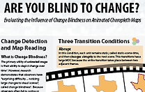
Fish, C. (presenter) and K.P. Goldsberry. Are You Blind to Change? Evaluating the Influence of Change Blindness on Animated Choropleth Maps. International Cartographic Conference 2009. Santiago, Chile: November, 2009.